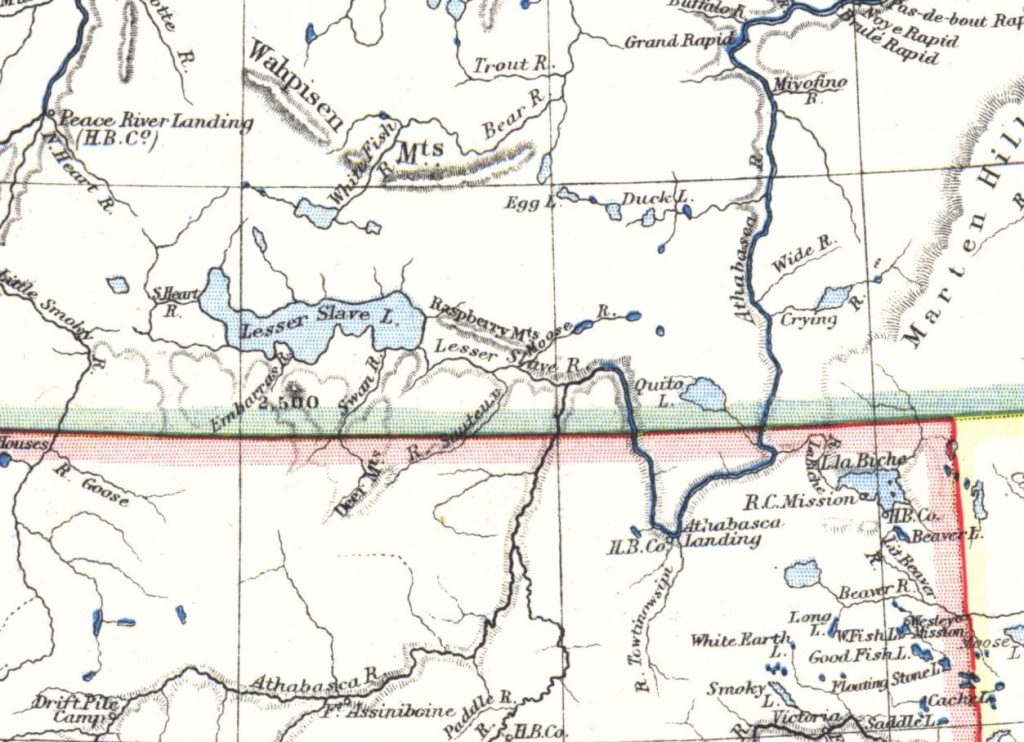
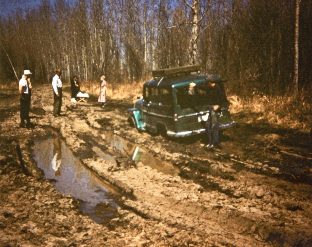
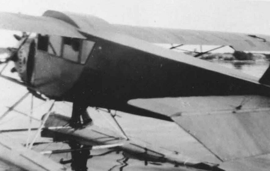
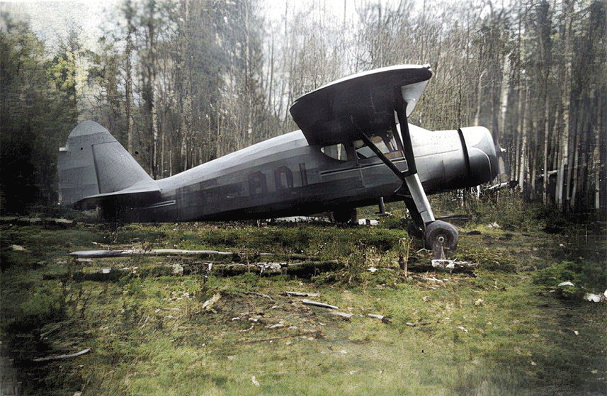
Modes of Transport

Content

Related Documents

Excerpts from Reflections from Across the River: A History of the Area North of Athabasca, published by the Northern Heights Historical Society in 1994

Often the question asked when exploring history is: “How did first peoples, first fur traders or first settler folk get here?” When one looks at a map of the Calling Lake region, the lake’s central location in the big bend of the Athabasca River suggests that, no matter the transportation mode, this river played a part as either a route to, or a barrier to, travel to Calling Lake.

Until the railroad stretched north to Fort McMurray/Waterways, the Athabasca River served as the major travel artery from the Rocky Mountains at Jasper through Athabasca to Fort Chipewyan and beyond. First Nations would have paddled the river by canoe in summer, switching to snowshoes and dog teams in winter; fur traders followed in larger canoes, later scows and finally river steamers.

Further map reading suggests correctly that the Calling and Pelican rivers provided access from the east, while a variety of smaller water connections provided access to the west. Heading north, Rock Island, Sandy and Wabasca lakes and the Wabasca River could be used, although with considerable portaging. Although these waterways were not prime canoeing routes, their valleys offered natural corridors for walking, and later for horse and cart trails. Early First Nations traveled to Calling lake largely in small parties with minimal gear, commonly in the winter for hunting and trapping, using snowshoes, toboggans and dog teams.

Access to Calling lake from the south was aided by the addition of river crossings at the town of Athabasca: a ferry in 1906 and a bridge in 1952. Even so, for decades settlers traveled along rutted and often muddy trails. Their creaking carts, pulled by horses, mules and even a few moose, were eventually joined by motorized vehicles, some homemade. Later, airplanes entered the scene, the better to access remote communities and faraway markets, and a small airstrip developed.

Understanding the evolving modes of transportation into Calling Lake is intertwined with understanding the waves of Beaver, Cree, Métis and other first peoples who passed through or made this place home, as well as the fur traders, missionaries and settlers who followed. How and why people traveled also reflects the economies that provided livelihoods in each era, from hunter-gathering societies through the fur trade, early agriculture, lumbering, commercial fishing and mink farming. All played a role in the choice of transportation routes and travel modes made by the people living here.

By Mark Lund, author of Mark’s Guide for Alberta Paddlers

“Stanley Crawford recalled walking down the pack trails following the telegraph line to Athabasca. On the way back home they would build a scow to float their supplies down the Athabasca to Calling River. Next was walking the twenty four miles to Calling Lake. They were back again the next day with the team and wagon to pick up the supplies.” – Evergreen Yearbook, 1966-1967

Waterways

In earlier eras, waterways served as highways for transportation and commerce. After all, getting anywhere by land meant traveling meandering, often muddy trails on foot or by horse. Calling Lake’s proximity to other rivers and lakes opened routes for people to come, initially to hunt, fish and trap – and later to live. Indigenous peoples often used waterways to follow the seasonal cycles of the animals and plants that met their daily needs. Fur traders, settlers, missionaries and lawmakers also used waterways to make their way here from all directions. 

Being linked to the Athabasca River via the Calling River gave this community access to a major trade route. Waterways also helped attract people from the Lac la Biche region, who would use the Lac la Biche River to reach the Athabasca River, then cross the river and follow the Calling River upstream. There are also tales of people traveling down the Athabasca River by scow to the mouth of the Calling River, then walking overland to Calling Lake. Travelers from the Slave Lake area took the Slave River to Mirror Landing (now called Smith), then followed creeks and small lakes to Orloff Lake and continued south to Calling Lake. Those coming or going from Wabasca and other points north welcomed the opportunity to stop for food and rest at Rock Island Lake, which also connects to Calling Lake by a liquid umbilical cord.  Although much of today’s commerce comes by paved roads and air routes, waterways remain key to Calling Lake’s heritage as a hub with vital connections to communities near and far in all directions. 

Calling Lake’s link via the Calling River to the Athabasca River proved an asset in the days when waterways served as key highways for trade. Photo: Tawatinaw, Sectional Map No. 415, Human Footprint Mapping Project
In this 1885 map, what we now know as Calling Lake is labeled “Quito Lake.”

There’s some evidence that Calling Lake may have gone by other names in earlier days. It shows up on this 1885 map as “Quill Lake” and in the map below as “Quito Lake.” We have also seen it called “Echo Lake” and “Talking Lake.” For more about the lake and its names, click on Historic maps of Calling Lake.

Francis Cardinal with a canoe, a much-used form of transportation in and around Calling Lake. Photo courtesy of Ike Glick, Mennonite Voluntary Service collection
Calling Lake Forest Ranger Ernie Stroebel with the M.V. Calling River, early 1960s. The boat, also called “Inchworm,” was used by the forest service to patrol the Athabasca River downstream from the Calling River. Photo shared by Forest History Association of Alberta

Roads and trails

We can only imagine the network of trails made over the centuries by Indigenous people coming to Calling Lake seasonally to hunt, fish and forage – and by the animals who roamed here, including buffalo. Trails meandered to places we know now as Lac la Biche, Wabasca and beyond, often following the lay of the land. We would love to know more about those routes, and about the people who used them.

“Our wagons were stuck in the mud, and the muskeg was bottomless. We built bridges, cut roads and put up corduroys. Some of our cattle drowned in the streams. So to cheer us up, we stopped for two days and decided to make some firewater. No mistake, it really was firewater. Our throats were in flames and brought tears to our eyes. One week later, we finally reached our destination, Calling Lake.”

– Nick Tanasiuk, describing his initial journey from Athabasca in 1920

Some of those trails were widened and straightened over time as newcomers arrived with carts, horses and eventually cars. But it took decades for passable roads to be built. Even after the rough road from Athabasca was graveled and given multiple bridges, the trip from Calling Lake took two days or longer by land. Logs laid side by side over low spots to create “corduroy roads” only slightly reduced the likelihood of being mired in the mud. Into the mid-1950s, people talked about driving the route “slideways” after a rain. Locals living near low spots became known for their generosity in extracting vehicles caught in the muck.

Several homesteaders have been engaged in the self-imposed task of clearing a roadway for the freighters hauling fish from Calling Lake. This will mean a saving of three miles and is situated north of Thorn’s Store. The new road is also being made with the idea of obviating the big hill close to Shank’s stopping place, which is encountered on the old route. The boys deserve the benefit they will undoubtedly receive as soon as the bulk of fish traffic is diverted to the new roadway.”

– Northern News, January 8, 1915

As on the prairies, stopping places and villages sprang up about a day’s travel apart. Here people set up homes, offered lodging and traded with neighbours and travellers, making a living and a way of life. Some of those stops were seasonal, serving the people who followed the game. Among them was the Bill and Margaret McPherson farm, according to Reflections from Across the River. Located along the original winter road, theirs was the first farm travelers passed when journeying south from Calling Lake. As the pace of travel quickened, these little villages shrank, leaving little more than a trapper’s cabin, graveyard or campsites. 

“People who had to travel the long distance between Athabasca and Calling Lake with horses required two days to make a one-way trip. Many welcomed the stopover at Max and Mary Shwaga’s farm, about half way, for a time the last farmhouse along the road. After James McIntosh of Calling Lake purchased a truck, he often left it at the Shwaga arm and drove the rest of the way home with a team of horses. Some residents traveled to the Shwagas with a team and then caught a ride to Athabasca and back in the truck, returning to Calling Lake the next day.”

– Reflections from Across the River, p. 431

Rock Island Lake, about 35 kilometres north of Calling Lake, is not shown on early maps, probably because it had just one main river, and that connects only to Calling Lake. Yet it became a key community for travellers needing food and lodging between Calling Lake and Wabasca. Hosts there included the Tanasiuk family, who are honoured at Rock Island Lake Campground for the role they played in the area’s development.

Mail carrier Jakie Gislason did not let anything bar his way, according to his story in Reflections from Across the River. When flies swarmed, he smeared a mix of pine tar, creolin, creosote and grease (often bear) on his horses. When the road became impassable, he’d unhitch his wagon, put the mail on the pack horse and ride to Calling Lake. Later his conveyances included cars, trucks and a Ford truck. For some time in the 1940s, he also took mail once a month to Pelican Portage, 10-day round trip by boat or kayak in summer, by pack and saddle horse in winter, often three ponies hitched tandem to a toboggan.

Descriptions in Reflections from Across the River of the ways fish were transported from Calling Lake to market illustrate how transport evolved in early settler times. In and around the 1920s: “Some fishermen delivered to Athabasca by team on the first winter trail, known as ‘fish camp trail.’ It went west of Calling Lake to the Athabasca River, and down the river to Athabasca.” By 1932: “A train of horse teams hauled the fish to Athabasca, making a round trip in four days. To speed delivery to distant markets, Arthur Brown of Colinton, AB used Reo trucks, meeting teams from Calling Lake at Kirkpatrick’s Stopping Place.” By then, fish buyer James McIntosh had an airplane that could make the round trip to Athabasca and back in an hour with 700 pounds of fish.

RN Elma (Riehl) Knapp, a nurse with the Mennonite Voluntary Service unit beginning in 1956, doing her rounds despite a typically rutted road. Photo courtesy of Mennonite Voluntary Service
“Road to the north side,” photographed by anthropologists from the University of Alberta working in Calling Lake, summer 1968.
Cleophus Cardinal running a dogsled, an essential mode of northern transport in the days before snowmobiles and quads.
The Crawford children make their way to school by dogteam. Photo: Evergreen Yearbook, 1966-1967
Jake Gislason’s most dependable means of transportation. In 48 years as the local mail carrier, his numerous conveyances included such home-made vehicles as an ahead-of-the-curve ski-mobile. Photo: Evergreen Yearbook, 1966-1967
Jim McIntosh’s bombardier could go anywhere. Photo: Evergreen Yearbook, 1966-1967

Milestones in the upgrade of roads connecting Calling Lake with other communities include the following:

  • 1906 – The first ferry begins crossing the Athabasca River near the Athabasca settlement. In winter, travel switches to an ice road.
  • 1917 – A crew led by Oscar Crawford completes a road between Athabasca and Calling Lake through a low area called Deep Creek.
  • 1919 – A road from Athabasca to Calling Lake is surveyed.
  • 1920 – Crews led by Oscar Crawford vastly improve the road, although it still uses corduroyed logs when crossing muskeg at low points and is hard going in places. The road runs along the west side of Hay Lake, crossing into Calling Lake at the mouth of the Calling River via a bridge.
  • 1921 – The rough road from Athabasca is graveled and multiple bridges put in, but getting there still takes two days, or even longer.
  • 1930 – Free ferry begun at Athabasca settlement.
  • 1934 – A cage is installed at Athabasca crossing so people and goods can be shipped during spring and fall, when neither river nor ice crossings are possible.
  • 1931 – Buffalo Bill Day and Joe Uchytil begin blazing a more direct route to Athabasca. Work is done manually and completed in 1933.
  • 1940 – A paved highway opens between Athabasca and Calling Lake.
  • 1940s – Advocacy for a bridge across the Athabasca River are rebuffed, in part due to competing priorities during the Second World War.
  • 1944 – Area road begin getting their first coat of gravel. Pulled out of pits on horse-drawn fresnos, the gravel was loaded onto loadlifters and deposited into trucks to be spread on the roads.
  • 1952 – A bridge opens across the Athabasca River, making it possible to reach Calling Lake without relying on a ferry or ice bridge.
  • 1958 – A road to Sandy Lake is completed by an oil exploration company, although by 1971 the Metis Regional Council hears a call for improvement, as “The roads are bad for the people to come out on.”
  • 1962 – Provincial plans for a road to Fort McMurray show two possible routes: east of the Athabasca River from Lac La Biche or west of the river from Calling Lake. As built, Hwy 63 runs west of the Athabasca River but not from Calling Lake.
Two new river crossings were completed in the area by 1993, one across the Athabasca River (left two photos), the other across the Calling River (right photo). Both were part of a new Calling Lake Connector or “C Road” running north from the Al-Pac millsite to Hwy 813 just north of Calling Lake. Photos shared by Forest History Association of Alberta
Francois Auger of Calling Lake, enroute to Orloff Lake, Oct. 31, 1995. Glenbow Archives, Terry Gavin fonds, SPC-2019-28_06-07
  • 1989 – Road to Wabasca from Calling Lake opens. The 180-km route along Hwy 813 improves access for residents, tourists, forestry and the oil and gas industry.
  • 1992 – The road from Calling Lake to Rock Island is being widened and upgraded, but remains a fair-weather road, recalls Bruce Mayer, who lived in Calling Lake that year. “Once it rained, all bets were off.”
  • 1990s – Roads are added and upgraded to serve the Al-Pac pulp mill, which begins operating in 1992, and to serve other resource exploration. The resulting network of roads includes the Connector Road running east of Calling Lake and the 1000 Road on the south and west side of the lake.
  • 1993 – New bridges open across the Athabasca River and the Calling River, part of the new Al-Pac Connector or “C” Road north of the Al-Pac mill.

Sources include histories written by Dora Shwaga, by Avard Mann and the Kito Sakahekan Seniors Society and by the Northern Heights Historical Society

As indicated by the final entries in that timeline, Al-Pac’s decision to build a pulp mill in the area fueled expansion of the road network around Calling Lake, both to reach the forests needed to feed the mill and to carry the product away. The Calling Lake Connector, or “C” road facilitated local traffic, running north from the millsite, to just north of Calling Lake, where it joined Hwy 813. The route was among a set of roads built under a “roads to resources” program funded by Alberta Transportation. Much of the work was done by local contractors, an approach strongly advocated by then-MLA Mike Cardinal. Among the contractors involved were Frank Crawford, Rudy Wiselka, Pac Construction, Pacholoks and Uchytils.

Al-Pac built the 1000 Road to serve one of the first areas around Calling Lake to be logged. It travels west off the “C” road south, north of Pleasant Valley, to Hwy 813, curves around the south end of Calling Lake and continues to the west side of the lake. The network of roads also included a “K” road on the east side of Al-Pac’s Forest Management Agreement, running from the millsite up to Heart Lake – and others, as needs arose. Off those main connectors, Al-Pac created other haul roads to carry logging equipment and loads of logs. Many of those remained dry-weather rather than all-weather roads. The public can use haul roads for free, but other industrial users sign a road use agreement with Al-Pac to cover maintenance and damage.

Given all those advances and more, the trip from Athabasca to Calling Lake these days takes little more than a half hour by car.

“Lovely Calling Lake Opened to Motorists by New Highway: The new Calling Lake road is now passable for cars, and a number of people have been up fishing and bathing in the lovely old Calling Lake, which promises to be one of Northland’s finest lakeside resorts. 150 miles straight North from Edmonton, the lake is teeming with the finest whitefish in Canada and for years large shipments have been made to New York & Chicago… Appreciation for the good work of road foreman Art Laporte, who stretched his appropriation to make the trail into a highway. Our fishermen also remember how the Edmonton trucks picked up the fish at the nets daily last winter, a convenience never before possible till the good work done on the road. Calling Lake is calling city tourists for camping, bathing, fishing and yachting de luxe.”

– Reflections from Across the River, quoting Athabasca Echo, August 2, 1940

“The old forestry road from Calling Lake to the Calling River was a key piece of infrastructure. Built by the Alberta Forest Service in the 1950s and 1960s, my guess is it followed what might have been an old trapper and Indigenous trail from the Calling and Athabasca Rivers to Calling Lake itself.”

– Bruce Mayer, who lived in Calling Lake in the 1990s while working as a forest ranger with the Alberta Forest Service.

Air travel

With travel by land difficult around Calling Lake in earlier days, airplanes entered the scene earlier than one might think.
Robin, Calling Lake's first plane, owned by J.H. (James) McIntosh
James McIntosh was the first local trader to fly fish in northern Alberta. He purchased the the first privately owned plane in Calling Lake in 1934, perhaps even earlier. Called “Robin,” the plane was used to haul fish and furs from remote communities to Calling Lake and other centres. The Athabasca history book titled Reflections from Across the River describes pilot Joe Irwin picking up 700 pounds of fish “right on the ice” and making the round trip to Athabasca and back in an hour, adding, “In Athabasca, the fish were boxed and sent to Edmonton by truck, then on rail express to New York.” Fishermen got five cents a pound; in New York, where whitefish were in especially high demand, the fish sold for over a dollar a pound.
Pilots flying in to Calling Lake preferred landing on the smaller, calmer Duck Lake a bit east of town. The community’s first airstrip was located here, along a sand ridge on the northwest side of the lake. Now known as Hay Lake and nearly dry at times, it’s favoured these days for its quadding terrain and blueberry patch. Photo shared by the Collyer family

Various pilots flew for McIntosh, recalls Jim Bissell, who has roots in Calling Lake and Wabasca. “But anybody could fly fish to McIntosh, and he took it from there. Most times they dropped fish in either Calling Lake or Slave Lake, and from there it went by truck to Edmonton.”

One well-known area pilot, Charlie (Junior) Fix, once told Jim Bissell that he’d crashed seven Cessna 180s, some of them so totally that they couldn’t be salvaged. Generous in providing rides, Junior regularly carried passengers (including Jim) in the rear, with no seats. Jim recalls a time when Junior’s right ski broke off on take-off from Sandy Lake. With an overload of unbelted passengers, he flew to Wabasca and circled to burn off fuel while dropping loose items overboard. Jim was among the spectators as the plane jounced down on one ski and spun, its passengers intact but shaken.

“Junior would stay where anyone would take him until he wore out his welcome,” Jim Bissell recalls. “But he paid his way with transport and mercy flights. The nuns in Wabasca knew if they got ahold of him or Mel Zachary of Bayview Air Service, they’d get help.”
Ike Glick learned to fly so he could provide air service while leading a Mennonite Voluntary Service Unit in Calling Lake between 1955 and 1969. Flying a Piper Cruiser
Cessna 170, and later the Cessna 180 shown here (right photo) at Calling Lake, he would ferry people, supplies and news between isolated communities. Photo shared by Ike Glick

Ike Glick, who led a Mennonite Voluntary Service unit headquartered in Calling Lake from 1955 to 1969, learned to fly so he could reach outlying communities as needs arose, whether landing on wheels, skis or floats. Like others who flew, he experienced the dangers of flying in the north and told tales of narrow escapes, including one involving a pregnant passenger, a broken front ski and a flipped plane. Again, all passengers survived.

Ike reflects on his flying days

I started out with the Piper Cruiser. And then the Cesna 170 for floats, but it didn’t have the power needed for taking off with a load on floats. Then the way opened to get a 180 that had more muscle.

They were used planes. Lindford Hackman, who owned the first plane and whose health failed at the right time for us to get the use of his plane, continued to be supportive and helped us locate planes. He was more familiar with the field of aviation than I was. The 180 was purchased in Ontario, and then he and I went to Ontario and flew the plane back.

Read more
Walter Kiehlbauch crashed in heavy brush while delivering fish from Peerless Lake to Calling Lake for McIntosh Fish Co. in 1941, and did not survive. Photo courtesy of Alice B. Donahue Library & Archives; Article Edmonton Bulletin, Feb. 11, 1941, Newspaper.com

Not all were so fortunate. Case in point: Walter Kiehlbauch was delivering 600 pounds of fish from Peerless Lake to Calling Lake for the McIntosh Fish Co. on a clear but windy February day in 1941 when his plane crashed in the Pelican Mountains. He did not survive. The wreckage of this Curtiss-Robin plane was spotted from the air north of Calling Lake, but planes could not land due to heavy tree cover and ground searches were turned back by waist-deep snow and severe cold. More than three months later, two Indigenous trappers found Kiehlbauch’s body beside the plane, which was upside down near a broken tree. The cause of the crash remained unknown.

Yet pilots persisted in challenging the elements and providing essential service by air.

“I knew Junior Fix mostly by reputation. He apparently walked away from several plane crashes. He liked to give people rides in his plane and try to turn them green by doing loops and other aerial manoeuvres. He was considered a skilled pilot.” – Wendy Ellefson, who lived in Calling Lake as a child while her dad ran the Ellefson sawmill
Mae McIntosh (left) of the local general store watches as pilot Charlie (Junior) Fix unloads furs at Calling Lake in 1961. Photo: Collyer family
A project of the Calling Lake Community Society

Land Acknowledgement

Recognizing that we are all equally responsible to know our shared history and journey forward in good faith, we acknowledge with respect that Calling Lake stands on land, and alongside water, where Indigenous peoples have gathered, hunted, fished and held ceremonies from time immemorial.

Our Funders